
Map system
Maps in oziTarget Map
A Windows moving-map built around offline MBTiles — the same idea as a calibrated raster in Ozi Explorer, packaged as a fast tile pyramid. If you already maintain Ozi .map files, most of your know-how still applies.
Map Tools
Map-making tools (Ozi Explorer conversion, calibration, and MBTiles build) ship as a separate download package — not inside the main installer. That keeps the app download smaller for pilots who only fly with ready-made maps. The package includes the GDAL tools needed to build maps, so you do not need to install GDAL yourself or hunt for it on the web.
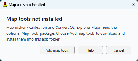
The first time you convert an Ozi Explorer map or open Map Calibration to make a new map, oziTarget Map prompts you to add Map Tools, then downloads and installs them into the app folder. You only fetch them if you need them.
How the map system works
The primary map layer is an MBTiles file (.mbtiles): a SQLite database of image tiles at multiple zoom levels. When you open a map, the app streams only the tiles needed for the current view — fast pan and zoom without loading a full megapixel image on every move.
You can also use online basemaps (OpenStreetMap, satellite layers) from the Map menu when you have internet. Competition and club charts are usually delivered as calibrated MBTiles you build or receive.
A project (.otmp) captures a reusable venue setup: which map to use, an optional viewport, datum/grid hints, and linked waypoint and track files — mirroring the Ozi habit of saving a map set for an event.
Convert Ozi Explorer maps
There is a dedicated Convert Ozi Explorer Maps tool that runs the conversion for you — nearly one click from a map you already use in Ozi Explorer to an MBTiles file ready for oziTarget Map.
For the conversion to work you need a registered copy of Ozi Explorer running, with the map you want to convert already loaded. Trial or unregistered Ozi Explorer will not work for this step.
Calibrating a new chart
Any new raster that is not already an MBTiles file — club task map, scanned plate, photo export, revised edition — goes through calibration once. Then you reuse the .mbtiles for every flight.
- 1 Help tab — skim in-window notes.
- 2 Map tab — enter map name, datum, projection (or import an Ozi .map).
- 3 Point 1–15 tabs — set each GCP by Lat/Lon or UTM; click the image or type Image X/Y; lock placed points.
- 4 Save — write an .otcal bundle (raster copy + JSON + all slots) for backup.
- 5 Build — with at least three GCPs, choose a preset and zoom range, then build (Map Tools supplies GDAL).
Tips for a good calibration
- Spread GCPs across the whole sheet — corners, edges, interior.
- Use grid intersections or unmistakable features.
- Snap to 1000 m grid for UTM and Swiss metric entry.
- Spot-check alignment at several zoom levels before task flying.
GDAL comes with Map Tools
You do not need a separate OSGeo4W or QGIS install for map building. Map Tools includes the GDAL binaries the Build tab uses to produce Web Mercator tiles (EPSG:3857) inside the MBTiles container.